


|
 |
|
Stopwatch Maps Gets "Muddy" In Texas
3Ě29Ě2004
Stopwatch
Maps, a leader in mapping
technologies and data solutions, now offers the assignment of Municipal
Utility Districts ľ referred to as ôMUDĺsö ľ as an addition to
the Taxography Property Tax Geo-Referencing Service.
ôRight now, weĺre able to provide this information for two
counties in
Texas
:
Fort
Bend
and Harrisö says Matt LaMartina of Stopwatch Maps.
ôEach year, these districts give tax professionals a headache
because theyĺre difficult to identify.
In
Harris
County
alone, there are over 700 MUDĺs in addition to
School Districts
, Cities, Townships, and Villages.
Some of these MUDĺs, like
Pecan
Park
in
Harris
County
, are less than 1/10 of a square mile in size.ö
For tax departments, knowing which districts their sites fall into before filing their returns makes a huge difference from a budgeting
standpoint. Matt explains,
ôIn Texas, companies are required to file their return to the county ľ
which, in most cases, isnĺt that
daunting of a task. However,
later in the year, when the tax bills start piling up, tax departments
soon realize that, not only does their site fall within Harris County, but
also the Southeast Harris Census County Division, the La Porte ISD, the
City of La Porte MUD, and the City of La Porte ľ each with their own
rates. From a billing
perspective, this is tough to plan for; thatĺs one reason our service is
so popular ľ we provide this information upfront, before the return is
filed.ö
Using the Taxography Geo-Referencing Service, tax departments simply
send their site address information to Stopwatch Maps.
The data is then sent through a series of spatial programs designed
to scrutinize each address with the intention of assigning a
latitude/longitude coordinate. Once
assigned, the sites are then placed on a digital map and, using the core
functions of geographic information systems (GIS), analyzed to determine
the various jurisdictions surrounding each site.
This information is then appended to each record and sent back to
clients within 48 hours ready for use with their property tax software.
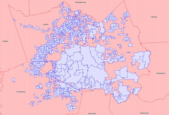
Map of
Fort
Bend
and
Harris
Counties
.
MUDĺs are blue.
For more information about Stopwatch Maps and the Taxography
Property Tax Geo-Referencing Service, contact Matt LaMartina at (800)
348-6277 or matt@stopwatchmaps.com
or visit our website at www.stopwatchmaps.com.
|
|
|
|
|
|